Mapping & GIS Services
The mapping team at Vector Geomatics have extensive technical expertise in mapping software, data conversion, spatial modeling, cartography and production mapping design to GIS, and mapping & remote sensing projects.
At Vector, we use the latest software from providers like ESRI, LizardTech, Safe FME, among others to accurately convert, store, and retrieve our spatial data. The data sets are downloaded from various government ministries and related industry providers such as Forestry, Oil & Gas Commission and Abidata AbaData. Vector Geomatics’ datasets are also derived from highly accurate survey data that is generated in-house from our own field surveys, as well as past surveys conducted by other survey firms. By referencing this data collectively, our clients are able to visualize and analyze sensitive areas that could impact project sites with data being shown from multiple interest holders.
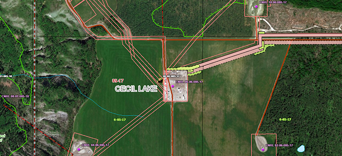
Our maps are an important tool in the planning for land and natural resource management, municipal property, oil and gas applications, emergency response and more. Our GIS, Mapping and Remote Sensing capabilities allows our clients to plan projects in advance, saving them time and money.

Mapping Services:
Aerial Photography Maps
P & NG Group Grid Maps
Land Owner Maps
Pipeline Specification Maps
Route Maps
Emergency Response Maps
Water Source Maps
Constraints Mapping
Custom Mapping (including web mapping leveraging ArcGIS Online)
If you are interested in our Mapping services please contact us.
Our Experienced Team Can Help
Whether you need land surveying, GIS or drafting services; our agile team is ready to meet your needs.
