OGC Applications
The Application Management System is the BC Oil and Gas Commission’s new online portal for the submission and payment of oil and gas permit applications.
The Application Management System (AMS) is the BC Oil and Gas Commission’s new online portal for the submission and payment of oil and gas permit applications. With the introduction of the new AMS, the Commission has updated the spatial data submission process and corresponding spatial requirements. Spatial data is now a crucial part of the Commission’s application process directly through the OGC AMS. Applicants no longer need to submit spatial data through ePASS and provide their reference number as part of the application. In the AMS, once the applicant selects the activity type(s) included in the application, the applicant is queued to upload the corresponding spatial data.
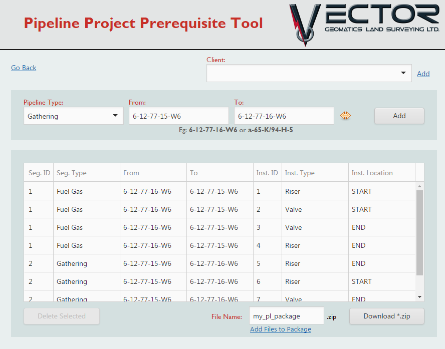
To help aid with the transition into the new system, Vector Geomatics has created a suite of custom tools that allow you to produce accurate spatial data for submission through the OGC Application Management System. These tools save time and simplify the process, enabling you to get the application submitted faster.
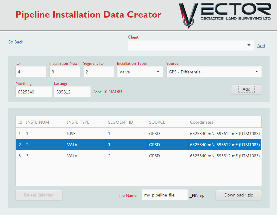
Pipeline Installation Tool
Point of Diversion Tool
Our Point of Diversion tool creates the shapefiles necessary for short term water use (Section 8/10) applications.

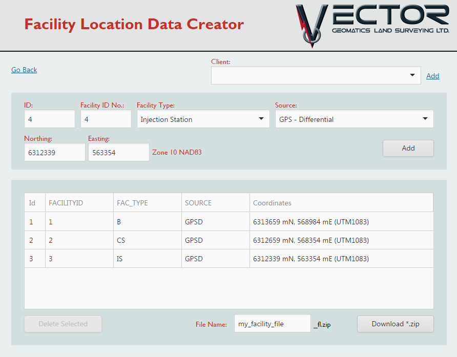
Facility Point Generation Tool
Pipeline Project Prerequisite Tool